Raised Relief Map of the Moon Manufacturer,Supplier and Exporter in India
Product Code : JA-AE-7199
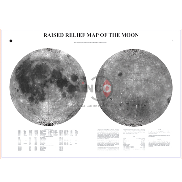
The Raised Relief Map of the Moon (SKU JA-AE-7199) shows the lunar surface in raised relief, covering both the near side and the far side and marking the landing sites of lunar missions. It is drawn at a scale of 1:1,500,000, where one inch represents 240 miles, and measures 22 x 34 in. This moon relief map is supplied by JaincoLab for astronomy and earth science teaching.
Specifications
The map is 22 x 34 in (about 56 x 86 cm) at a scale of 1:1,500,000.
| Product | Raised Relief Map of the Moon |
| SKU | JA-AE-7199 |
| Type | Raised relief map of the Moon's surface |
| Shows | Near side and far side; lunar mission landing sites |
| Scale | 1:1,500,000 (1 in = 240 miles) |
| Size | 22 x 34 in (about 56 x 86 cm) |
Uses of the moon relief map
Raised relief lets students see and feel craters, maria and highlands.
- Identifying maria, craters and highlands
- Comparing the near side with the far side
- Locating lunar mission landing sites
- Map scale exercises using 1 in = 240 miles
Scope of supply and ordering
The listing is for the raised relief moon map as described. Quantities, packing and delivery lead time are stated on each quotation.
Frequently asked questions
Does it show both sides of the Moon?
Yes, the near side and the far side.
What is the scale?
1:1,500,000, where one inch represents 240 miles.
How large is the map?
22 x 34 in, about 56 x 86 cm.
Related products
Other products in this group are in the astronomy equipment range.
Request a quote
Use the contact page to ask for a quotation on the raised relief map of the Moon, giving the SKU JA-AE-7199 and the quantity. Institutions and contractors buying under a tender can also reach us via the tenders page.